Hiking in Colorado
If you’re in Colorado – anywhere in Colorado – hiking awaits you right outside the door. Of course the Rocky Mountains present endless options, from lazy trails to bushwhacking climbs up a cliffside. BLM offices have maps for wilderness areas all around the state, and visitors’ centers can provide you with information on trail difficulty, time the hike might involve, what you should take with you (Water, sunscreen, bug repellent), what to watch for in the way of wildlife and weather, and how to dress. Consider downloading a hiking app; however, beware that cell service is limited at best in National Parks and Wilderness areas. Taking an appropriate map is always the no-fail fallback.
Hike Like a Local
Perhaps you’re new to hiking or even if you have been a hiking enthusiast for years; it’s a good idea to brush up on trail etiquette. With more and more people out on the trails it’s especially important to be respectful of each other and of nature. Many ‘Do’s and Don’ts’ are common sense such as ‘don’t litter’ and ‘stay on the trail’. However, there are aspects that are not so obvious especially to the newcomer such as, ‘don’t pick the wildflowers’ and ‘dogs must be on a leash’. It’s a good idea to brush up on trail etiquette and know the local rules and regulations before heading out.
Colorado Hiking Destinations for Every Type of Hiker
For those who want a hike to satisfy a curiosity such as a historical destination, something off the beaten path, a place that you can take a quick mountain swim or perhaps you’re looking for a suggestion for your next backpacking trip. We have some recommendations for this discerning group of outdoor enthusiasts.
Colorado Wildflower Hikes
Hiking in Colorado during wildflower season is a true sensual experience. As you may know, spring in the mountains comes later than normal and works its way up in elevation as summer progresses. Typically, mountain wildflowers are at their peak during mid-June through July. Although the season does extend all the way through September in higher elevations. If experiencing wildflowers is your pursuit we have some ideas for you to consider.
Hikes Perfect for Families
Hiking is a really wonderful activity for the whole family. As an innate form of travel, hiking provides that quality-time needed to create memories and bond in the great outdoors. With so many hiking trails available in Colorado, finding those perfect family hikes can be a challenge. Check out our selection of family hikes. You might also try asking at a local sporting goods store, the local visitors’ center or the like.
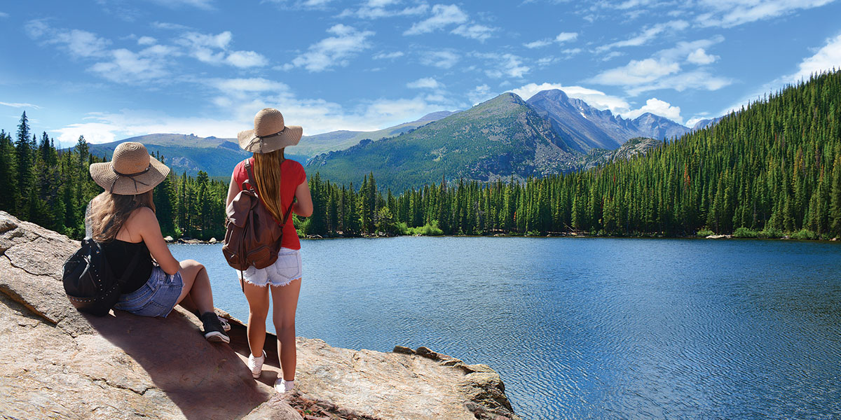
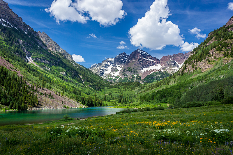
Rocky Mountain National Park Favorite Hikes
Rocky Mountain National Park is a real Colorado gem for outdoor enthusiasts and hikers in particular. Visiting this area is a must do. Stay for a while and check off this list of RMNP favorite hikes. You will not be disappointed.
Hiking Near Denver
Denver, a major hub, draws all sorts of people from all around the world. For whatever reason you find yourself in Denver, consider yourself lucky, as the Colorado experience is right around the corner. Check out our recommendations, perfect for those with just a lunch hour of time or an afternoon. Perhaps you need to spin your wheels or get the dog out. Denver is just as amazing as the rest of Colorado, as it offers outdoor experiences to suit all types.
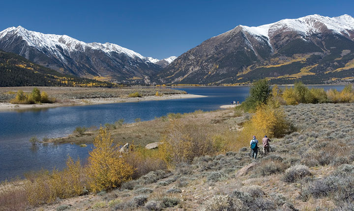
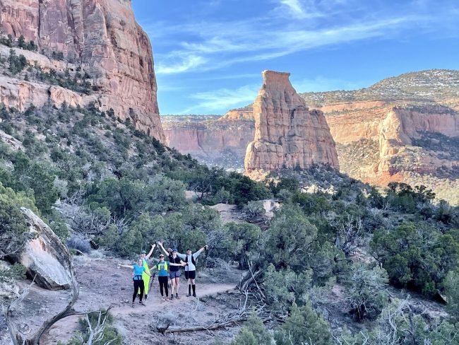
Hike a Colorado 13er
Although it’s impressive and popular to bag a Colorado 14er. The actual experience is losing quality due to the crowding on the trail these days. This is why we suggest turning your focus to those slightly less famed 13er peaks. Be ready for achieving solitude and wilderness glory that is becoming harder to find on the more popular treks.
Hiking, Biking & Four-Wheeling at Royal Gorge
The Royal Gorge region, a notable attraction in southeast Colorado, dishes out Colorado extremes for all types. If you’re in the Colorado Springs area, take some time to visit the Royal Gorge. The arid climate and extensive canyon-lands accommodates mountain bikers, hikers, and 4-wheel travel enthusiasts, year-round.
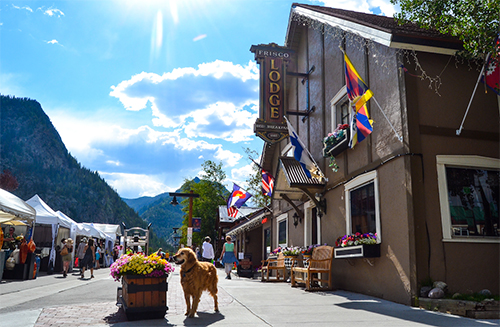
Ouray Hiking Adventures
Ouray Colorado, with its dramatic mountain setting, has become a popular hiking destination. Enthusiastic locals in the area have created a trail group to help support trail etiquette and provide information about their wonderful trails. Learn more about hiking in Ouray Co.
5 Fantastic Colorado Winter Hikes
Although hiking is most commonly thought of as a summer time activity. There are hikes that appeal to people in the off-season too. If you find yourself having a hard time hanging up the hiking shoes for the winter. Try these winter hiking trails.

Brew at the Zoo presented by Three Corners Connector
Apr 27
3455 Nuckolls Ave, Pueblo, COPueblo’s favorite festival is back for its 7th year! Pueblo Zoos Brew at the Zoo presented by Three Corners Connec
Battle MMA Championships 13
Apr 27
Norris Penrose Indoor Event Center, 1045 Lower Gold Camp Rd, Colorado Springs, COAn adrenaline-fueled epic night filled with fights! Local fighters go head-to-head in battle, showcasing their skills in

Collecting and Collections by Renowned University Expert
Apr 27
200 West Mountain Avenue, Fort Collins, CORussell Belk, Distinguished Research Professor and Marketing Chair at York University in Toronto, Canada, will present C
International Trivia Night
Apr 30
200 West Mountain Avenue, Fort Collins, COThe ever-popular International Trivia Night will be held from 6-8 pm Tuesday, April 30, at the Global Village Museum of

237 Virginia Avenue
May 02 - May 19
2700 Arapahoe St, Denver, COSYNOPSIS When Eric, an overeducated and underemployed professor, begins researching the history of his father Rex’s pr

Maria Schneider Orchestra
May 03
2344 E Iliff Ave., Denver, COThe seven-time Grammy award-winning Maria Schneider Orchestra has been hailed by critics as “evocative, majestic, magi

Pack Rats at Heart: The Joys of Collecting
May 04
200 West Mountain Avenue, Fort Collins, COWith over 60 years of adventures collecting artifacts, Gary and Carol Ann Hixon will present Pack Rats at Heart: The Joy

Desert Highlights Trail Camp
May 10 - May 13
777 Grande River Drive, Palisade, COJoin us for a long weekend in the colorful desert landscape of Western Colorado! This year, we have partnered with Gemin
Resplendent Rachmaninoff – Fort Collins Symphony
May 11
417 West Magnolia Street, Fort Collins, COOur season closes with music that has captivated audiences in concert halls, movie theaters, and figure skating arenas f

Run to the Shrine
May 18 - May 19
4250 Cheyenne Mountain Zoo Rd, Colorado Springs, COJoin us on Saturday, May 18 or Sunday, May 19, 2024 for Run to the Shrine, Cheyenne Mountain Zoo’s annual fundraiser r